File:Indianocean.PNG
Indianocean.PNG (330 × 330 pixels, file size: 11 KB, MIME type: image/png)
Captions
Captions
| The image contains one or several undisputed inaccuracies.
It should not be used to illustrate or provide information about the subject, but may be kept in order to provide the basis for a corrected image. If you disagree that it may be useful for this purpose feel free to request deletion. Reason:
Map includes the Java Sea, which is a marginal sea of the Pacific Ocean. |
Summary
[edit]| DescriptionIndianocean.PNG |
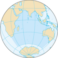
Беларуская: Карта Індыйскага акіяна (CIA FB 2002). English: Map of The Indian Ocean (CIA FB 2002). |
| Source | The World Factbook |
| Author | United States Central Intelligence Agency |
| Other versions |
|
Licensing
[edit]| Public domainPublic domainfalsefalse |
This image is in the public domain because it contains materials that originally came from the United States Central Intelligence Agency's World Factbook.
Bahasa Indonesia ∙ čeština ∙ Deutsch ∙ eesti ∙ English ∙ español ∙ Esperanto ∙ français ∙ galego ∙ hrvatski ∙ italiano ∙ Nederlands ∙ norsk nynorsk ∙ polski ∙ português ∙ sicilianu ∙ slovenščina ∙ suomi ∙ Türkçe ∙ Zazaki ∙ беларуская (тарашкевіца) ∙ македонски ∙ русский ∙ српски / srpski ∙ українська ∙ ქართული ∙ বাংলা ∙ தமிழ் ∙ മലയാളം ∙ 한국어 ∙ 日本語 ∙ 中文 ∙ 中文(简体) ∙ 中文(繁體) ∙ العربية ∙ +/− |
 |
File history
Click on a date/time to view the file as it appeared at that time.
| Date/Time | Thumbnail | Dimensions | User | Comment | |
|---|---|---|---|---|---|
| current | 19:18, 27 August 2019 |  | 330 × 330 (11 KB) | Kaldari (talk | contribs) | Reverting for consistency with the other ocean map images. If you remove the background, please remove it from all 5. |
| 22:08, 13 March 2017 |  | 330 × 330 (11 KB) | WikiBunny2K1 (talk | contribs) | Transparent | |
| 20:16, 22 August 2009 |  | 330 × 330 (11 KB) | Serg!o (talk | contribs) | language neutral map | |
| 11:34, 27 August 2005 |  | 330 × 330 (11 KB) | ScribeOfTheNile~commonswiki (talk | contribs) | Recompressed with OptiPNG on maximum setting. 21.05% filesize decrease. | |
| 09:39, 3 November 2004 |  | 330 × 330 (14 KB) | Maximaximax (talk | contribs) | Map of The Indian Ocean (CIA FB 2002) {{PD-USGov}} |
You cannot overwrite this file.
File usage on Commons
The following 5 pages use this file:
File usage on other wikis
The following other wikis use this file:
- Usage on en.wikipedia.org
- Usage on fa.wikibooks.org
- Usage on fr.wikipedia.org
- Golfe du Bengale
- Presqu'île de la Société de géographie
- Chimique (drogue)
- Mer d'Arabie
- Îles Montalivet
- Cap Comorin
- Kanhoji Angria
- Morengy
- Îles Laquedives
- Ko Phi Phi Le
- Île Ronde (Maurice)
- Île de la Passe
- Îles du Prince-de-Monaco
- Île aux Cerfs (Maurice)
- Cap Leeuwin
- Zabargad
- Détroit de Palk
- Île Bathurst (Australie)
- Convention de Nairobi
- Cap Guardafui
- Ghoubbet-el-Kharab
- Le Gouffre (La Réunion)
- Pate (île)
- Cap Negrais
- Bataille au large de Mullaitivu
- Îles Nuageuses
- Nosy Komba
- Mer d'Émeraude
- Îles de Boynes
- Presqu'île Ronarc'h
- Île du Port (îles Kerguelen)
- Île des Pingouins
- François Fidèle Ripaud de Montaudevert
- Îlot Channer
- Île du Roland
- Île du Prince-Édouard (Afrique du Sud)
- Long Island (Tasmanie)
- Unguja
- Île aux Cocos
- Sangeang
- Savu
- Îles Babar
- Détroit de la Sonde
- Îles Mentawaï
- Siberut
- Pasumpahan
- Enggano
- Simeulue
View more global usage of this file.
Metadata
This file contains additional information such as Exif metadata which may have been added by the digital camera, scanner, or software program used to create or digitize it. If the file has been modified from its original state, some details such as the timestamp may not fully reflect those of the original file. The timestamp is only as accurate as the clock in the camera, and it may be completely wrong.
| Horizontal resolution | 28.35 dpc |
|---|---|
| Vertical resolution | 28.35 dpc |


